The map as politics: why the UN decided to "correct" the image of the world
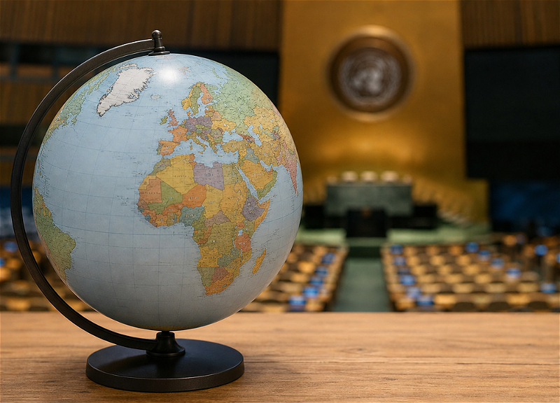
- The UN has decided to reconsider the familiar image of the world: 164 countries supported the "Correct the Map" initiative;
- What is the Mercator projection and why does it make Africa look visually smaller and northern territories larger?
- can a map be truly neutral if it is capable of influencing our perception of the world?
A map seems to be one of the most neutral ways to show the world. But the way countries and regions look on it can influence how people perceive their importance, scale, and even their place in world history. It was precisely around this thesis that an unusual dispute unfolded at the UN — and it turned out to be far more political than it might seem at first glance.
On September 4, the UN General Assembly at its 80th session adopted the resolution "Correct the Map: restoring balance in global cartographic representation and promoting a fair representation of the world's regions, especially Africa."
164 countries voted in favor of the document, one against: the United States. Six more states — Estonia, Georgia, Lithuania, Moldova, Serbia, and Ukraine — abstained.
The initiator was Togo on behalf of the African Group with the active support of the African Union.
At first glance, this is about cartography. In reality, it is about who shapes the visual representation of the world and how.
When a map distorts reality
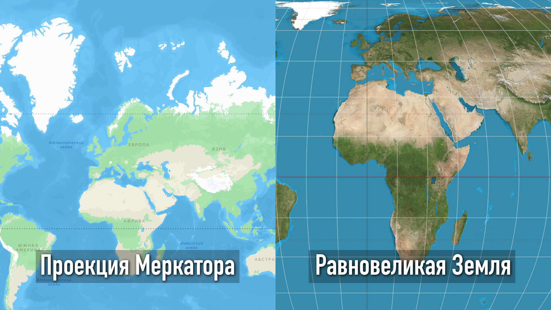
The African side's main complaint concerns the Mercator projection — one of the most widespread ways of depicting the globe on a flat surface.
The argument of the African side is that the widespread use of maps in the Mercator projection systematically distorts the real sizes of Africa and other equatorial regions in the direction of reduction. For generations, this has shaped a distorted mental perception of the world.
The problem has been known for a long time: the farther a territory is from the equator, the more it is visually enlarged. As a result, Europe, North America, and the northern regions of Eurasia look significantly larger on the familiar map than they actually are, while Africa and other equatorial regions turn out to be visually reduced.
In other words, in the Mercator projection:
- Africa looks smaller than its real size;
- Europe looks significantly larger compared to Africa;
- North America and the northern part of Eurasia are similarly exaggerated;
- equatorial regions are visually compressed.
An illustrative example is Greenland, which on the Mercator map may appear comparable to Africa. In fact, Africa is about 14 times larger than Greenland.
This feature in itself is not a mistake by cartographers. The Mercator projection was created primarily for navigation: it preserves angles and directions well — nothing better has been invented since the 16th century.
The problem arises when a map convenient for one practical task begins to be perceived as an objective picture of the relative sizes of the world.
This is precisely where a technical question turns into a political one.
Togo and the countries that supported the initiative argue that maps are not simply technical objects, since they influence how society perceives the world. Generations of people were shaped under the influence of such a visual representation. Therefore, maps influence not only geographical knowledge, but also education, historical memory, and the perception of the relative significance of regions.
The resolution proposes making wider use of equal-area projections, including Equal Earth, developed in 2018. It makes it possible to convey the ratio of the continents' areas much more accurately.
At the same time, the UN does not declare the Mercator projection incorrect and does not demand that it be replaced with a single new map. Moreover, the document does not directly address state borders, sovereignty, or territorial status.
What the resolution actually changes
Directly — not much. UN General Assembly resolutions of this kind are not legally binding. The document does not force states to abandon Mercator, does not establish a new mandatory world map, and does not change a single border.
But the political signal is far more serious.
The General Assembly has effectively endorsed the idea that the way the world is depicted matters. A map can be technically correct for one purpose and at the same time misleading if it is used as a universal representation of geography.
This concerns primarily education, public information, publishing products, and digital cartography. And if this logic is consistently extended to maps, textbooks, museums, and online services, over time it may change the familiar visual perception of the world.
However, behind the cartography lies a larger political process.
In recent years, African states and other countries of the Global South have increasingly been questioning the structures and representations formed during the period when the international order was largely determined by Western powers. Hence the demands to reform international financial institutions and the UN Security Council, to reconsider the colonial legacy, to achieve greater representation, and to change historical narratives.

"Correcting the map" fits into the same logic.
In this sense, it is not so much about replacing one projection with another as about an attempt to change the very approach to what is considered a neutral depiction of the world.
Why the United States voted against
It is precisely the political context, and not the advantages or disadvantages of equal-area cartography, that explains the American vote.
Washington opposed the resolution because it saw in it part of a broader ideological agenda linked to such concepts as reparations and "cognitive justice."
The US representative stated that the UN should concentrate on international peace, prosperity, and good-neighborly relations, and not on initiatives that Washington considers symbolic or ideological. The United States also warned that such documents could undermine the authority of the organization.
Thus, the American "no" should be regarded primarily as a political objection to the context of the resolution, and not as a denial of the fact that Mercator distorts the sizes of territories at high latitudes.
It is telling that the United Kingdom, on the contrary, supported the document, although it expressed reservations regarding the interpretation of historical cartographic projections as a manifestation of historical injustice. London also drew attention to potentially sensitive issues that could arise when using political maps based on Equal Earth, in particular with regard to Crimea.
Nevertheless, the British side supported the resolution, since it does not in itself define political borders.
The world has not been redrawn — but the dispute about it has changed
The UN has not "redrawn the world" and has not banned the Mercator map. The resolution does not change borders and does not create a new mandatory system of cartography.
Its significance lies elsewhere.
For the first time at such a level, the General Assembly has so clearly linked cartographic depiction, education, historical memory, and the political perception of the world. And the almost unanimous vote showed how broad the support was for the very idea of revising the familiar Western-centric ways of representing global space.
For Africa, this is a question of visibility and fair representation. For the Global South — one more element of a broader demand to reconsider the legacy of the former international order. For the United States — an example of how the UN, in Washington's opinion, is increasingly going beyond the limits of its key functions.
And perhaps the main conclusion here is not about which particular map should now be hung on the wall.
A map has never been simply an image of the world. The question is through whose eyes this world is seen on it.