Official place names of Karabakh updated on international digital map
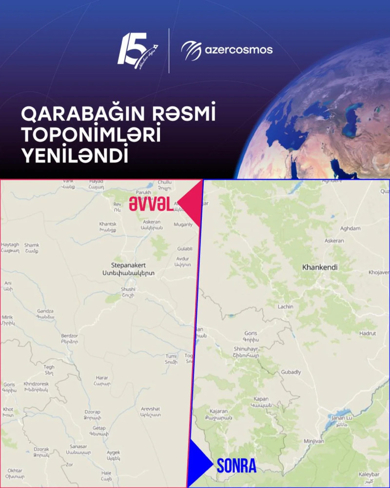
The base map of the territory of Karabakh provided by the international satellite data and analytics company EOS Data Analytics has been updated.
As Report informs, citing the Space Agency of Azerbaijan ("Azercosmos"), the names of Karabakh settlements that had previously been displayed in Armenian have been replaced with official Azerbaijani place names.
The Azercosmos team identified outdated settlement names on the base map and contacted the EOS Data Analytics team. During the appeal, the other party was provided with information published on Azerbaijan's official Open Data Portal (Opendata.az), as well as the relevant database confirming the official names of the settlements.
As a result of approximately 11 months of cooperation and information exchange, the EOS Data Analytics development team reviewed the official information provided and made the corresponding updates to the map of the territory of Karabakh.
As a result, the official names of Khankendi, Khojavend, Aghdere, Sugovushan, and other settlements of the Karabakh region are correctly reflected on the digital map.
This initiative contributes to the correct representation of Azerbaijan's official geographical names on international digital maps and to providing users around the world with up-to-date and reliable information about the territory of Azerbaijan. The update also demonstrates that official open data plays an important role in improving the accuracy of information on international maps.